
Monday night into Tuesday provided a good bout of winter, with snow, wind and cold. Next up is a mostly calm period for a couple days. Temperatures rise, as do breezes Thursday and Friday. A shot of snow is possible before the weekend, but the next widespread precipitation arrives Saturday night into Sunday afternoon. The bulk of that storm hits early next week, with snow expected Monday into Tuesday.
A powder alert went out for the Snowy Range Ski and Recreation Area this past Tuesday, thanks to the seven inches of snow that blanketed the slopes overnight. Snow depth measurements likely varied, thanks to the accompanying wind action. One skier reported conditions are excellent, thanks to the repeated bouts of snow over the past few weeks. The next round of snow should arrive Sunday into Monday.
Northwest Wyoming also got significant snowfall Tuesday. That was especially true at Grand Targhee, where a whopping 24 inches of snow fell. Another 41 inches is in the forecast through next week. While not as impressive, but still significant, 15 inches fell on the slopes at Jackson Hole Mountain Resort on Tuesday, with another 30 inches forecast through next week.
To the south, in Colorado, the Tuesday storm delivered just a glancing blow, with ski areas reporting 1 to 5 inches of snow. In general, Steamboat continues to come out the winner, with skiers and snowboarders enjoying 15 inches of new powder late last week. Another 21 inches is in the forecast through early next week. That area has a snowpack depth of 111% of normal.
Skiers and riders at Winter Park enjoyed blue skies much of last weekend. The forecast is for another 20 inches by the middle of next week. The snowpack there to 107% of normal.
Personnel at the Colorado Avalanche Information Center report the avalanche danger for the southern Wyoming and northern Colorado mountains is rated “considerable” at all elevations. New snow and strong winds create very dangerous avalanche conditions, at least until Friday. An avalanche was reported in the Sierra Madre Mountains last Sunday on the Eastern Wyoming Avalanche Information Exchange. Snowmobilers reported the hillside was fine when they initially went by, but it had slid by the time they returned 45 minutes later. The 300-foot slide was approximately a quarter-mile wide and 4 to 7 feet deep.
At Keystone, near Rob Roy Reservoir, there has been a total of 162 inches of snow so far this season, according to Don Day Jr. at dayweather.com. This is a 23-inch increase from last week, and includes the seven inches that fell Monday night into Tuesday. According to Open Snow, the snowpack in the Snowy Range is 94% of average for this time of year, an increase of nine percentage points from last week.
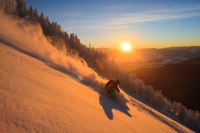
Conditions “up top” in the Snowy Range are very good, but strong winds continue to take some of the fun out of it. Those breezes pick up again this Friday and Saturday, with snow expected late Saturday into Sunday. Base depth across the Snowy Range varies from 4 to 7 feet, with plenty of powder. Fresh snow Monday night into Tuesday measured 7 to 11 inches.
Backcountry skiers report excellent conditions on all trails accessed via Highway 130. Thanks to the annual Poker Run last weekend, there should be a solid base on the Barber Lake Trail under the recent new snowfall. Snowshoers reported very good conditions with deep snow on the Little Laramie area trails.
Conditions are quite good at Chimney Park and along the Medicine Bow Rail Trail. As of Tuesday morning, there was no recent grooming since early in the month. Expect user-packed conditions for both those on skis and snowshoes.
Conditions on the Nordic ski trails at the Happy Jack Recreation Area are very good, but the recent strong winds create variable conditions. Coverage is good, with daily grooming of the skate lanes and resetting of the classic tracks as needed when conditions allow.
The multi-use trails are likely quite soft with the new snow Tuesday. While they are packed, those using the trails should be mindful if they are leaving significant ruts or “postholes” and opt to return another day when conditions provide a solid base.
As of Tuesday morning, the U.S. Natural Resources Conservation Service snow measuring stations reports 53 inches of snow at Cinnabar Park, an increase of two inches from last week. The station at Brooklyn Lake reports 65 inches, an increase of two inches from last week. The report at Sand Lake on the north end of the Medicine Bow Mountains is 76 inches, an increase of four inches from last week. The measuring station at Medicine Bow Peak, at an elevation of 10,500 feet, reports 93 inches, a decrease of two inches from last week. The Crow Creek station on Pole Mountain shows 14 inches, a decrease of an inch from last week.
Cross-country skiing
Pole Mountain/Happy Jack Recreation Area Nordic ski trails: Conditions on the Nordic trails are good to very good for both classic and skate ski techniques. Daily grooming is underway.
Pole Mountain/Happy Jack Recreation Area Multi-use trails: Conditions are very good with packing for runners, fat bikers and snowshoers. Expect soft conditions with the new snow and in drifted area.
Chimney Park Nordic ski trails: The trails are in very good conditions and user-packed. There’s no recent grooming as of Tuesday morning.
Snowy Range backcountry conditions: Excellent conditions with deep snow. Trails are all user-packed, and suitable for skiers and snowshoers.
Snowmobile conditions
Snowy Range: Conditions are excellent up high with a 4- to 7-foot deep base. Be aware of instability and avoid steep areas where the new snow is more prone to slides.
Quick Numbers
Wyoming downhill areas
Snowy Range Ski Area: 50-inch base; 5 lifts, 33 trails and 100% of terrain open.
Antelope Butte: 16-inch base; no additional information available.
Grand Targhee: 97-inch base; 6 lifts, 89 trails and 94% of terrain open.
Hogadon: 55-inch base; 2 lifts, 28 trails and 100% of terrain open.
Jackson Hole Mountain Resort: 86-inch base; 13 lifts, 129 trails and 98% of terrain open.
Meadowlark Ski Area: 26-inch base; 2 lifts, 12 trails and 86% of terrain open.
Sleeping Giant: Closed this season.
Snow King: 52-inch base; 8 lifts, 41 trails and 87% of terrain open.
White Pine: 22-inch base; 2 lifts, 22 trails and 76% of terrain open.
Colorado downhill areas
Arapahoe Basin: 50-inch base; 9 lifts, 136 trails and 94% of terrain open.
Breckenridge: 54-inch base; 33 lifts, 187 trails and 100% of terrain open.
Copper Mountain: 59-inch base; 23 lifts, 155 trails and 99% of terrain open.
Eldora: 31-inch base; 10 lifts, 65 trails and 100% of terrain open.
Keystone: 49-inch base; 21 lifts, 140 trails and 100% of terrain open.
Loveland: 51-inch base; 10 lifts, 93 trails and 99% of terrain open.
Steamboat: 106-inch base; 23 lifts, 181 trails and 100% of terrain open.
Vail: 62-inch base; 33 lifts, 275 trails and 100% of terrain open.
Winter Park: 68-inch base; 19 lifts, 167 trails and 99% of terrain open.
Let the news come to you
Get any of our free email newsletters — news headlines, sports, arts & entertainment, state legislature, CFD news, and more.
Explore newsletters